Teledyne
Mining, Quarries & Aggregates
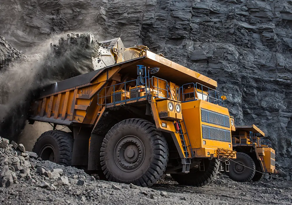
Revolutionizing Mine and Quarry Operations: Teledyne
Teledyne is at the forefront of the Mine, Quarries, and Aggregates industry, offering a powerful suite of technologies that drive smarter, safer, and more sustainable operations.
Uncover Every Detail:
- Precise 3D Mapping: Our LiDAR scanners create detailed, digital landscapes of your mine site, enabling better planning, high wall monitoring, and pinpoint extraction accuracy.
- Clean Air, Healthy Workers: Our ACES air quality monitoring systems provide real-time data on dust and pollutants, ensuring a healthier work environment for your team.
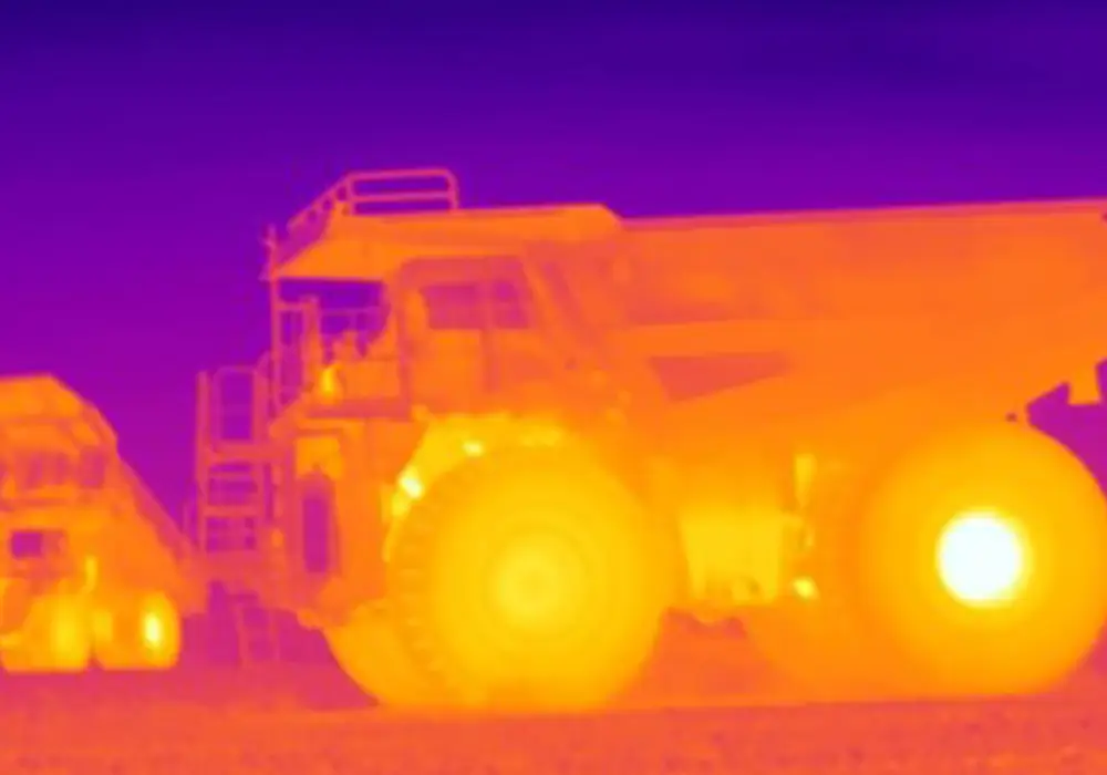
- Thermal Vision for Peak Performance: FLIR cameras with thermal imaging capabilities offer a crucial advantage in monitoring equipment health and preventing safety hazards.
Beyond Efficiency:
Teledyne goes beyond simply optimizing extraction. By seamlessly integrating these technologies, we empower you to:
- Boost Efficiency: Make data-driven decisions and optimize resource extraction for maximum yield.
- Prioritize Safety: Protect your workers with real-time environmental monitoring and equipment health insights.
- Embrace Sustainability: Minimize environmental impact with advanced monitoring and responsible practices.
Teledyne: The Future of Mining and Quarrying
We are committed to delivering comprehensive solutions that push industry standards forward and promote sustainable practices in mining and quarry operations. Let Teledyne be your partner in building a more productive, safe, and environmentally responsible future.
Market Solutions by IMT Technologies and Teledyne
See Beyond the Visible: Unveiling Earth’s Secrets with DESIS
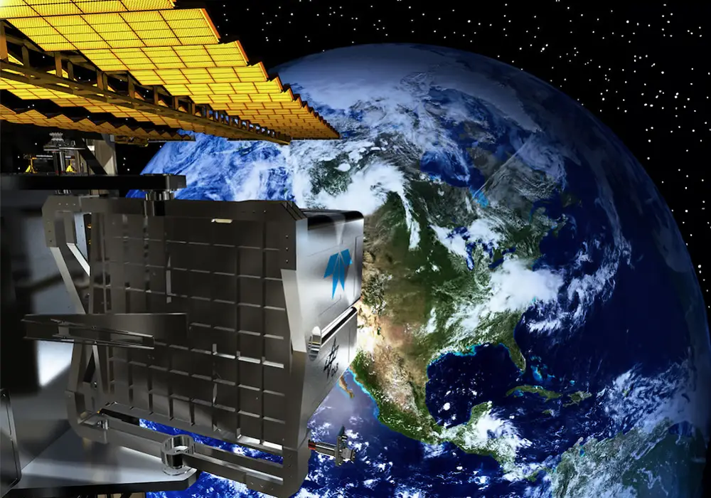
Orbiting Earth aboard the International Space Station (ISS), the DESIS Hyperspectral Imager, built by Teledyne and hosted on the MUSES platform, is a game-changer. This powerful instrument collects “invisible” data, capturing spectral signatures (or reflectance values) in the visual to near-infrared range with incredibly high detail.
What does this mean? Unlike what we can see with our naked eye, DESIS reveals hidden information about Earth’s surface.
The Power of “Digital Prospecting”:
This “digital prospecting” data is currently used by government agencies like NASA and the German Aerospace Center (DLR) for ongoing research. But the potential goes far beyond!
Unlocking Commercial Applications:
DESIS holds tremendous promise for commercial applications in various fields, including:
- Mining: Identify and locate valuable mineral deposits with unmatched precision.
- Forestry Monitoring: Track forest health, detect disease outbreaks, and optimize resource management.
DESIS is a revolutionary tool for understanding our planet like never before. By harnessing the power of “invisible” data, it paves the way for groundbreaking advancements in both scientific research and commercial applications.
DESIS (DLR Earth Sensing Imaging Spectrometer)
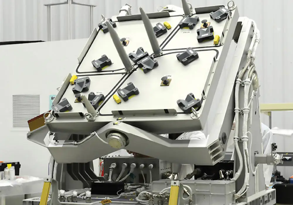
DESIS, the DLR Earth Sensing Imaging Spectrometer, was developed by the German Aerospace Center and Teledyne Brown Engineering. DESIS is a hyperspectral imaging spectrometer covering the Visible and Near Infrared optical spectral region (400-1000nm). Bands are natively spaced at ~2.55nm. The Ground Sample Distance or pixel size is ~30m and the image tile size is 30km by 30km. DESIS resides on the MUSES (Multi-User System for Earth Sensing) platform on board the International Space Station. MUSES is inertially stabilized and can be precision tasked to your AOI. DESIS represents a large leap forward in having a reliable, well calibrated, high SNR, hyperspectral sensor in space.
Operating on the ISS presents opportunities and challenges. The ISS provides the advantages of a fast, low cost route to space, instrument return, and opportunity to repair the instrument since it is a manned platform. Imaging is dependent on the ISS orbit and space-based activities, but covers 90% of the populated earth and has frequent cover of the tropics—areas where quality hyperspectral data is limited because of persistent cloud cover.
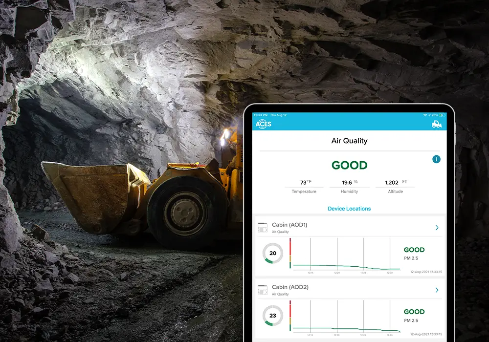
Real-Time Monitoring for a Healthy Cabin Environment
ACES® continuously monitors and records various air quality parameters crucial for your teams comfort and safety. These include:
- Temperature
- Humidity
- Carbon Dioxide (CO2)
- Carbon Monoxide (CO)
- Ozone (O3)
- Particulate Matter (PM)
Advanced Sensor Technology Detects Air Quality Issues
Using a sophisticated suite of sensors, ACES® can detect even trace amounts of potentially hazardous particulates and contaminants.
Proactive Alerts Keep Your Crew Safe
The system analyzes air quality data in real-time, and if any potential issues arise, it will alert the crew for prompt action.
Ensure a Safe and Comfortable Operator Station with ACES®
By providing real-time data and early warnings, ACES® empowers companies to maintain a healthy cabin environment for all machines.
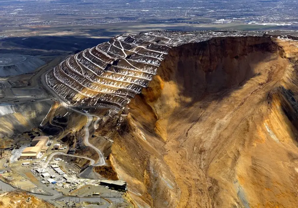
OPTECH LiDAR
The TLS-M3 Ruggedized real-time LIDAR system is used for slope monitoring to quickly identify potential safety issues. The TLS-M3 is a highly accurate and reliable system that can collect high-quality data in a variety of environmental conditions.
FLIR A-Series
The A615 is an easy-to-control thermal imaging camera for condition monitoring, process control/quality assurance, and fire prevention. Condition monitoring inspections and automated monitoring with fixed thermal imaging cameras allow mining companies to catch problems in their early stages – before equipment is compromised or destroyed and before costly accidents happen.
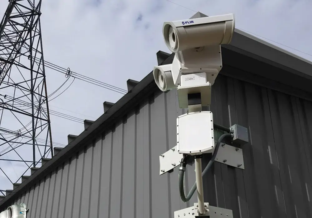
Teledyne FLIR Triton™ PT-602CZ HD
The FLIR Triton™ PT-602CZ HD is the most advanced dual-sensor security system, combining a uncooled 640 × 480 resolution thermal sensor, a 1080p HD visible-light imaging sensor, and a high speed, precision pan/tilt system. The Triton PT-602CZ HD integrates easily with major third party video management systems, making it an extremely versatile solution for critical infrastructure protection in total darkness, bright sun, and adverse conditions.
Fill out the form below and one of our Teledyne Specialists will get back with you.

