

Sodex Hardware Solutions
More Time Using Data. Less Time Collecting It.
SDX-Systems integrate laser scanning, camera technology, intelligent software, and durable hardware into a single, streamlined surveying solution for construction sites. Your existing heavy machinery becomes a fully capable survey unit — automatically scanning, documenting, and syncing site data directly to SDX-Cloud.
Sodex offers a range of SDX-Systems engineered to suit any machine and jobsite requirement. The SDX-Compact and SDX-Compact OnTop deliver powerful, space-efficient scanning solutions for a wide variety of construction equipment, while the SDX-4DVision combines advanced multi-dimensional capture for comprehensive site documentation. For teams that need flexibility on the go, the SDX-PocketScan provides a portable yet capable scanning option. Together, the SDX-Systems lineup ensures there is a purpose-built solution for every operation.
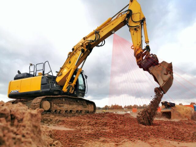
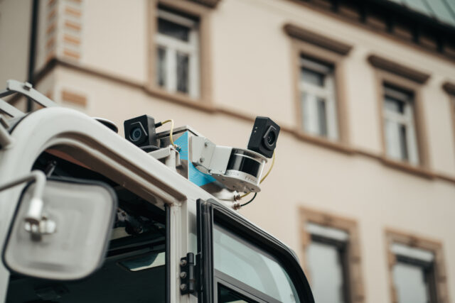
SDX-Compact
Machine. Scan. Total Overview.
The Sodex SDX-Compact is a LiDAR-based surveying system that converts standard earthmoving equipment into a mobile survey device. Mounted on a machine (typically loaders, dozers, and other earthmoving equipment — not excavators), it combines LiDAR scanning with GNSS positioning and integrated sensors that require no manual calibration, so installation takes only a few minutes and the unit can be moved between machines easily. As the machine works, the system continuously scans the surrounding terrain and uploads topographic data wirelessly to the cloud roughly every 10 minutes, producing as-built documentation without a dedicated survey crew. Common applications include earthmoving, road construction, landfill management, and automated stockpile monitoring for inventory volumes and material billing.
SDX-Compact OnTop
Progress mapped in real time.
The SDX-Compact OnTop is the 360° variant in Sodex Innovations’ SDX-Systems line. Like the standard SDX-Compact, it mounts to a machine’s roof using magnetic base plates, draws power from the machine (9–36 V), requires no manual calibration, and streams terrain data to SDX-Cloud automatically every 10 minutes while the equipment works. The difference is the sensor’s field of view: where the standard unit scans 180° to the rear at roughly 35 m, the OnTop captures a full 360° at around 40 m, with comparable accuracy (roughly 1–2 cm horizontal, 2–3 cm vertical). That all-around coverage makes it the better fit for stockpile measurement and volume tracking, quarry and aggregates work, mining, and general mobile mapping, where the machine needs to capture material and terrain on every side rather than just behind it.
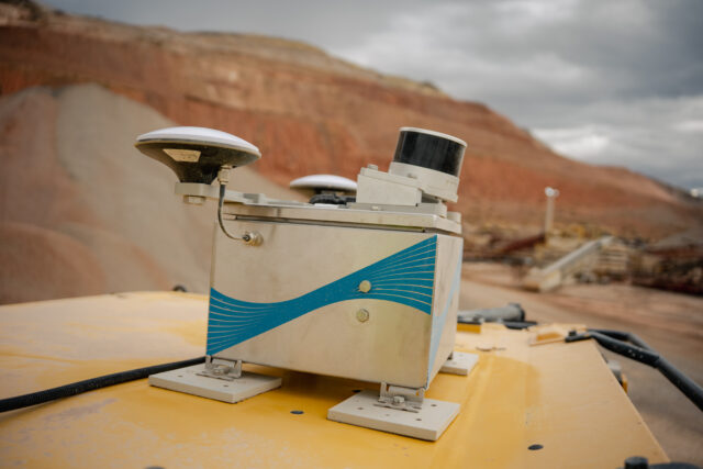
SDX-4DVision
Insights before the dust settles.
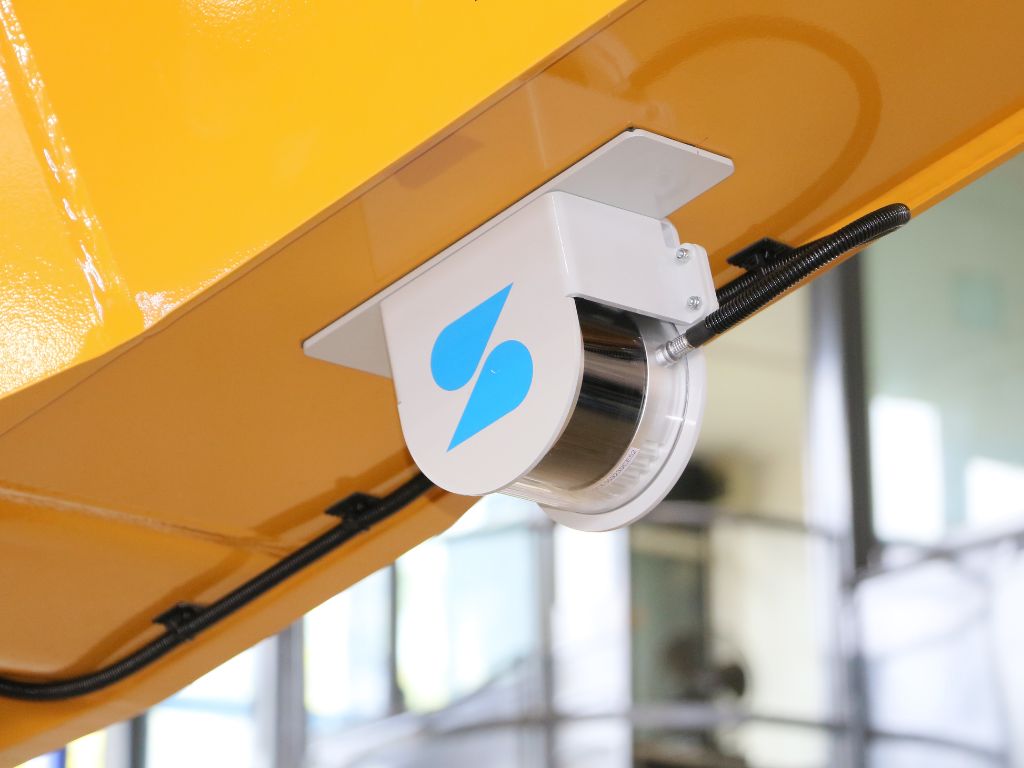
The SDX-4DVision is Sodex Innovations’ excavator-mounted system, and it’s the most capable product in the SDX line. Rather than sitting on the roof, its laser scanners and cameras mount under the excavator boom — positioned to look directly into the trench or excavation as the machine digs. It can be configured with different numbers of scanners and cameras, uses the machine’s existing GNSS and IMU sensors, and retrofits to any brand or size of excavator, with full integration into Trimble Earthworks so operators can run it from their existing tablet. The system captures millions of measurements per minute to build a georeferenced point cloud, and AI processing attaches attributes to each scanned point — including soil classification — so it reports in real time how many cubic meters of which material were moved. That makes it well suited to trench and pipeline construction, underground utility documentation, and any job where as-built records, material-based billing, and volume verification matter.
SDX-PocketScan
The decision is right in your hand.
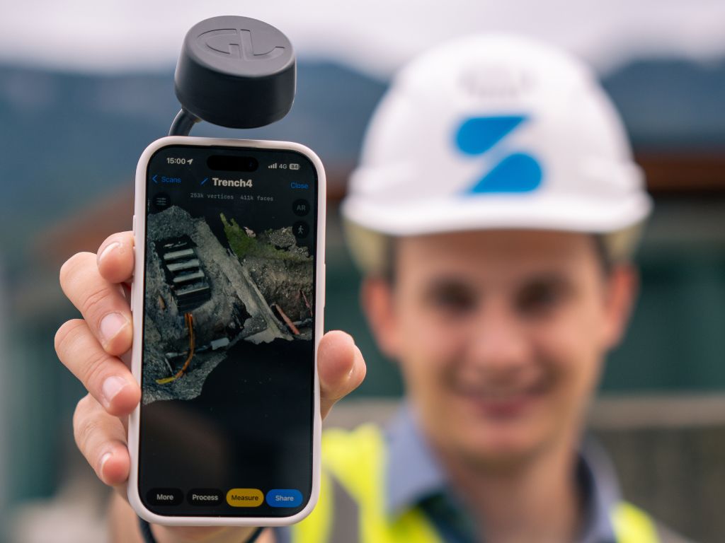
The SDX-PocketScan is the handheld member of the Sodex lineup — instead of mounting to a machine, it turns a smartphone into a portable 3D capture device. It supports both LiDAR and photogrammetry capture modes and, when paired with the SDX-PocketScan RTK receiver, delivers centimeter-level accuracy suitable for construction, surveying, and utility documentation. The pocket-sized form factor and simple app-driven workflow mean any field crew member can produce usable 3D models with minimal training, and captured data uploads to SDX-Cloud for processing within minutes — the same platform the machine-mounted SDX systems feed into. It fills the gap where a machine isn’t scanning: underground utility documentation, small site surveys, trench and as-built proof, landscape and earthworks jobs, and general job-site reporting and traceability.
Turn your heavy machinery into surveying devices.
Laser scanners and cameras map your terrain in real-time while the machines are working!